Buyeo Drone Education Center

Mission-ready even in extreme environments:
D-AIR’s core UAV control technologies

Going beyond flight alone, we combine AI vision with precision control technology to deliver solutions that protect industrial and public safety.

Autonomous Flight

Advanced Autonomous Flight Solution

Ultra-precise autonomous flight system based on sensor fusion and dynamics control

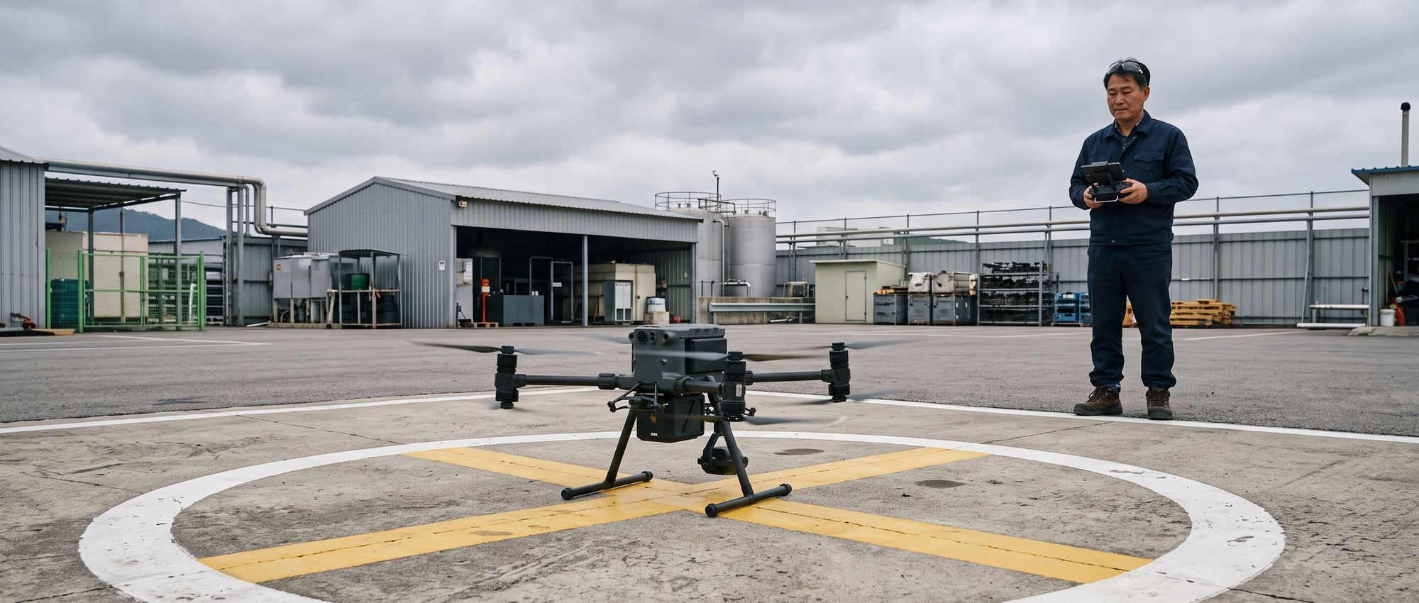
We achieve flight standardization that does not depend on pilot skill. RTK-GPS and multi-sensor fusion technology enable centimeter-level precision flight and automatic take-off and landing. This makes it possible to fly the same path on every flight and supports overlay analysis of the time-series data collected. A real-time collision avoidance algorithm based on 3D terrain recognition further minimizes the risk of aircraft loss and cuts the operating costs of repeat surveys.

Key Technology Elements

Advanced Autonomous Flight Solution
Multi-Sensor Fusion Multi-Sensor Fusion
Integrated analysis of data from heterogeneous sensors estimates and controls the aircraft’s precise 3D attitude and position regardless of environmental variables.
Optimized Flight Control Logic Flight Control Logic Design
A flight control computer (FCC) built on advanced robotics technology, paired with an airframe design optimized for it, maximizes operational stability and flight performance.
Wide-Area Scanning & Environmental Awareness Automated Flight & Scanning
With a wide-area detection capability covering 135 degrees to each side of the aircraft’s forward centerline (270 degrees in total) at a radius of up to 200 m, the system scans terrain features and obstacles along the route in real time for safe automatic flight.

AI Vision & Anomaly Detection

Intelligent Vision & Anomaly Detection Solution

All-weather object and anomaly analysis system based on AI deep learning

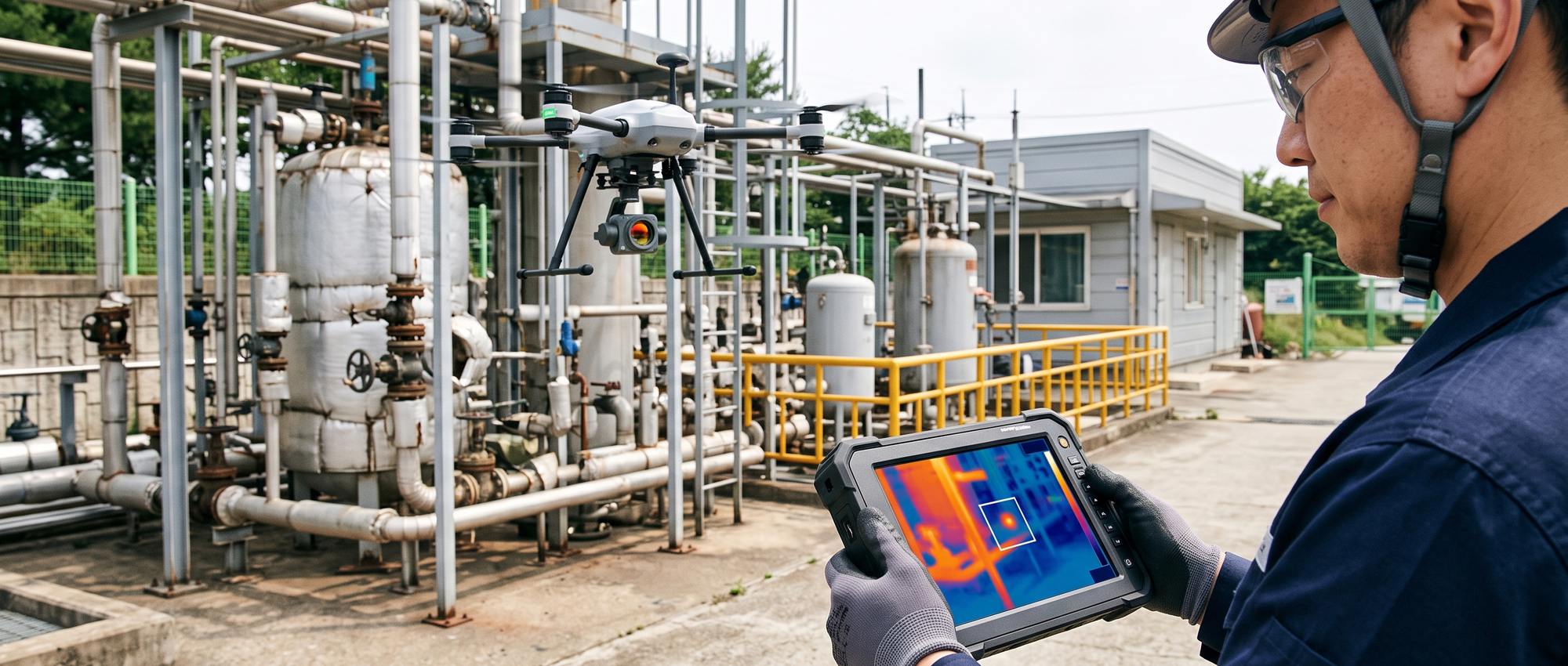
We overcome the physical limits of visual monitoring and optimize monitoring staff resources. High-resolution EO/IR cameras and thermal sensors combined with deep-learning vision analysis identify threats such as gas leaks, fires, fine cracks and abnormal movement 24 hours a day, regardless of day or night. Detected anomalies are reported immediately to the control center, establishing a proactive risk response system, and securing the golden hour minimizes potential accident losses and recovery costs.

Key Technology Elements

Intelligent Vision & Anomaly Detection Solution
Computer Vision-Based Object & Anomaly Detection Computer Vision Analytics
Advanced real-time image processing algorithms recognize abnormal behavior patterns and track target objects accurately and without delay.
High-Performance LiDAR Scanning System High-Speed LiDAR Scanning
Noise is kept to a minimum even when unmanned vehicles are flying or driving at high speed, supporting precise 3D spatial surveying and mapping.
Real-Time Synchronization of Video & Sensor Data Real-Time Data Synchronization
Seamless, ultra-low-latency data synchronization between unmanned vehicles, workers’ wearable devices and the control system, even at high speed, provides a comprehensive, integrated monitoring environment.

BVLOS Control

BVLOS Remote Control & Monitoring

Long-range, wide-area UAV control solution over multiple communication networks

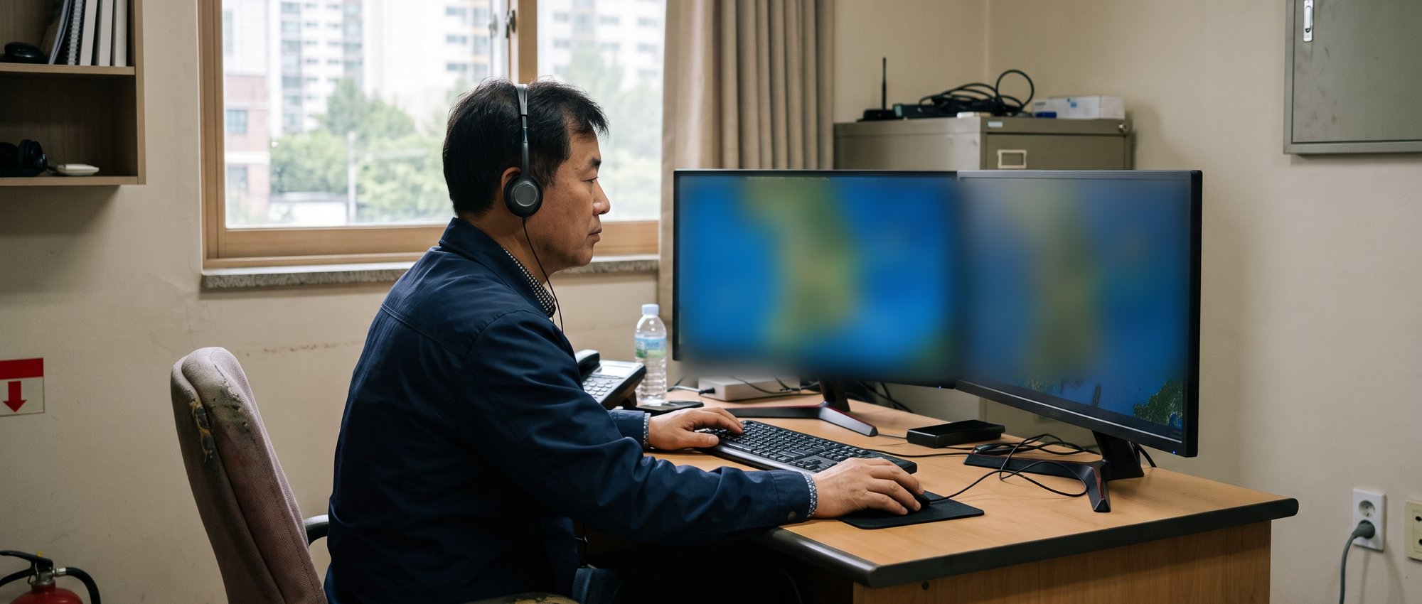
We support BVLOS missions in which wide-ranging infrastructure is inspected and controlled remotely, with no pilots dispatched to the site. A multi-network communication setup that combines commercial networks (LTE/5G) with an RF backup network minimizes coverage gaps and enables real-time control with minimal latency even on long-range missions beyond visual line of sight. In particular, a swarm operation architecture that lets one operator monitor and control multiple aircraft (1-to-N) covers wide areas quickly without additional deployments, delivering high operational efficiency.

Key Technology Elements

BVLOS Remote Control & Monitoring
AI-Based Ground Control Software Advanced GCS
Real-time video processing algorithms such as object tracking and abnormal behavior recognition are integrated into an intuitive control interface (UI), supporting immediate situational awareness and decision-making on site.
Communication Infrastructure Integration Network Integration
Communication modules optimized for Korea’s terrain and communication infrastructure are built into the aircraft, maintaining a stable remote control link regardless of physical distance.
Intelligent Mission Continuity & Safety Response Fail-Safe & Contingency
When a communication anomaly is detected, the system switches automatically to the backup network (Fail-over). If all alternative links are lost or a critical situation such as low power occurs, a multi-layered protection system automatically returns the aircraft to a preset emergency point (RTH) and lands it safely.

Unmanned Helicopter Control

Unmanned Helicopter Precision Control System

Helicopter-specific control solution for overcoming weather limits and performing missions efficiently

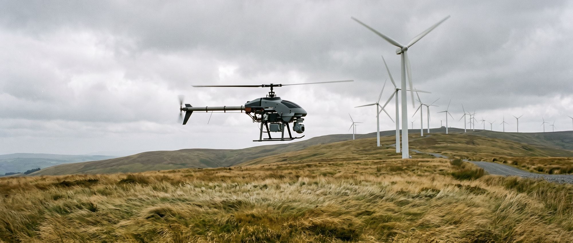
We reduce the risk of operational delays and schedule disruptions caused by bad weather. Precision control technology with heavy payload capacity and excellent wind resistance maximizes flight time compared with conventional multicopters and expands the mission coverage achievable in a single sortie. Dynamic balancing control minimizes airframe vibration for high-quality data collection, helping you keep strictly to essential infrastructure inspection schedules regardless of weather and other environmental variables.

Core Technical Capabilities

Unmanned Helicopter Precision Control System
High-Efficiency Electrified Systems Electric-Powered Flight Technology
Advanced electric propulsion technology combined with lightweight airframe design reduces both initial build costs (CAPEX) and long-term operation and maintenance costs (OPEX).
Heavy-Lift Airframe Design for Special Missions 25kg+ Heavy-Lift Platform
With in-house capabilities to design and build large unmanned helicopters that meet the Class 1 ultralight flying device standard (maximum take-off weight of over 25 kg), we provide custom platforms for high-load mission environments.
Multi-Purpose Platform with Integrated Robotics Robotics-Integrated System
By applying advanced robot control technology to conventional unmanned helicopter control systems, we have achieved the versatility and scalability to handle a wide range of industrial sites and complex missions, well beyond a single purpose.

Enterprise Integration & Security

Enterprise Data Integration & Security

Seamless integration with your existing infrastructure and secured data integrity

We provide a data integration and security architecture that turns the large volumes of spatial and video data collected by unmanned flight systems directly into real business value. It integrates flexibly with your existing IT infrastructure so the data can be put to use immediately.

Core Technical Capabilities

Enterprise Data Integration & Security
System Integration via Open APIs Open API Integration
Collected data is integrated in real time with your ERP, GIS (geographic information system) and EAM (enterprise asset management) systems, supporting digital twin and smart factory environments.
End-to-End Data Security Data Security & Encryption
Data is encrypted across the entire path from aircraft to network to control center (using AES-256 and other methods), reducing the risk of leakage of sensitive industrial security data.

What Sets D-AIR Technology Apart

Whether a technology holds up in the field comes down to three things.

Safety First

Safety

A triple fail-safe system returns the aircraft automatically if the link is lost and performs an emergency landing when necessary.

Scalability

Scalability

A modular architecture makes it easy to integrate a wide range of mission equipment, including LiDAR, gas detectors and loudspeakers.

Reliability

Reliability

A field-tailored solution proven through demonstration projects and military and public-sector test beds.

Technology Architecture

D-AIR develops autonomous agent drones that see, decide and act on their own. They are designed so that a human can step in on the decision whenever safety or ethical judgment is required.

Solutions and Use CasesSolutions & Use Cases

  1. Solar power plant panels are imaged with thermal cameras, and areas of abnormal temperature distribution (hotspots, etc.) are analyzed to detect defects.

  2. Blades and other exterior parts of wind turbines are imaged and checked for damage without interrupting turbine operation. Inspection of a turbine that has stopped for lack of wind is also included.

  3. High-rise structures (wind turbines, etc.) are inspected for internal defects such as cracks using X-ray radiography.

  4. The status of drones and drone docks (bases for automatic take-off, landing and charging) is monitored in real time and controlled remotely.

Domain-Specific TechnologiesDomain-Specific

Organizes inspection results and automatically generates customer reports.

Evaluates how well each drone suits a mission based on factors such as payload, and assigns a drone suited to the mission.

These technologies recognize a wind turbine, measure and estimate its state, and photograph and inspect its blades.

Wind Turbine Recognition · Blade Imaging

Image Stitching · Anomaly Detection

These technologies monitor, control and support drones as they carry out missions.

Drone Monitoring and Control · Drone Swarm Monitoring and Control

Performs perception, decision-making and action on its own, and hands the judgment over to a human when an ethical or risky judgment is required.

  • Draws up a mission plan for the autonomous agent based on the mission objective and the surrounding situation.

  • Carries out the planned mission through actual operations.

  • This system performs perception, decision-making and action on its own, and hands the judgment over to a human when an ethical or risky judgment is required.

The aircraft flies by itself without pilot intervention.

  • Integrates localization, mapping and path planning to fly on its own from take-off to landing without pilot intervention.

  • Flies along the surface of a structure while maintaining a constant distance from it.

  • Takes off and lands at a designated position using camera-based recognition.

Protects the aircraft and its surroundings in hazardous situations during flight. It first avoids the hazard on its own, then asks a human to decide on the next action.

  • If the communication link with the control center is lost, the aircraft returns to its take-off point on its own (RTH, Return-to-Home) or lands automatically.

  • Calculates the distance to an obstacle as the aircraft approaches it, and avoids it.

  • When a dangerous situation arises, first avoids it on its own to secure safety, then requests a judgment on the next action from the human monitoring the aircraft.

Generates the travel path to the destination in advance, avoiding obstacles.

  • Generates movement paths for indoor and outdoor environments.

  • Generates flight paths around high-rise structures.

Calculates the aircraft’s position and builds a map of its surroundings.

  • Calculates the position of the aircraft.

  • Builds a map of the surrounding environment.

Recognizes targets and calculates distances from image and point cloud data.

  • Distinguishes individual objects in an image and separates the region of each object at the pixel level.

  • Calculates the distance (depth) to nearby objects from camera images.

  • Separates individual objects in 3D Point Cloud data collected by LiDAR and identifies their types.

Recreates real environments virtually to develop and validate technologies. Technologies are validated first, before they are applied in the field.

  • Synthesizes realistic images to generate data for AI training and validation.

  • Applies physical laws such as gravity, inertia and collision to virtually reproduce the behavior of the aircraft and its environment.

Foundation TechnologiesFoundation

Ensures the accuracy of sensor data.

  • Corrects each sensor’s inherent measurement error and the relative position and orientation between sensors to achieve measurement accuracy.

  • Combines data from multiple sensors to produce information that is more accurate and stable than that from a single sensor.

Aligns data collected from different positions and viewpoints into a single coordinate system.

  • Aligns 3D Point Cloud data collected from different positions and viewpoints into a single coordinate system.

  • Aligns images captured from different positions and viewpoints into a single coordinate system.

Recognizes and transforms images and makes AI models lightweight.

  • Identifies the type and location of target objects in an image.

  • Analyzes an entire image and classifies it into one of the predefined categories.

  • Classifies every pixel of an image into predefined categories to separate regions.

  • Estimates the pose (position and orientation) of subjects such as humans and objects in an image.

  • Restores low-resolution images to high-resolution images.

  • Recognizes characters in an image and converts them into text data.

  • This lightweighting technique lowers the numerical precision of an AI model to reduce its size and computational load.

Implements services and applications.

  • Processes and analyzes image data, including quality enhancement, filtering and transformation.

  • Processes and analyzes 3D Point Cloud data, including noise removal, filtering and transformation.

  • Processes and analyzes sensor and speech signals, including noise removal, filtering and frequency transformation.

  • Processes and analyzes human speech data.

  • Uses GPUs and similar hardware to process large volumes of computation simultaneously, improving processing speed.

  • Processes AI and other computation in real time on the aircraft’s onboard computer.

  • Visualizes 3D spatial data and models on screen.

  • This immersive visual technology encompasses virtual reality (VR), augmented reality (AR) and mixed reality (MR).

  • Develops the user interface (UI) of web services.

  • Develops servers (backend).

  • Develops applications for smartphones and tablets.

  • Processes, analyzes and visualizes location-based data such as maps and coordinates.

Transmits, receives and stores data inside and outside the aircraft and between control systems and servers.

  • Sends and receives data in real time between modules inside the onboard computer through Publish-Subscribe communication.

  • Sends and receives data between drones in a swarm, between the aircraft and ground control, and between the control center and servers or the cloud through Publish-Subscribe and Query communication.

  • Stores, retrieves and manages spatial and time-series data such as inspection results, GIS coordinates and flight telemetry.

As of October 2026 Technologies in the lower layers serve as the foundation for those in the upper layers

See real solutions powered by
D-AIR’s innovative technology.


D-AIR

D-AIR Co., Ltd.  |  CEO Jeong Yeong-seok  |  Business Registration No. 415-87-02399
Rooms 220–221, Dowon Sangga Bldg., 216 Munhwa-ro, Naju-si, Jeollanam-do, Republic of Korea
Phone 061av5-33z4u1-645caj02  |  Email dauzkir6ukj402kfw@ffnavecer.cok0m
COPYRIGHT © D-AIR. ALL RIGHTS RESERVED.